
MAGALLANES - Patagonia Chile
- Francesco Lena
- Jun 22, 2025
- 4 min read

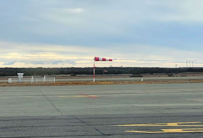
We arrived on March 5, 2022, on a Saturday, after a trip to the side of a large part of the Andes mountain range, coming from Santiago. Punta Arenas airport is located on the seashore, and is one of the few in the world with three runways that intersect at different angles. The region is punished by Antarctic air masses, which means that, even with the differentiated infrastructure, pilots are challenged to land with a good amount of crosswind. It was an exciting landing.
The bad weather, even though we could only see it through the window of the landed aircraft, scared us a little. Everything on the runway, including boxes of frozen salmon, was flying around. For a moment we wondered if it would be a good idea to try our luck at tents in such weather.
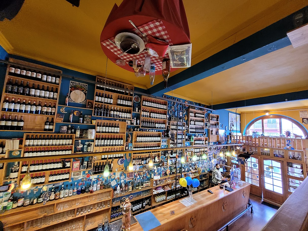
Punta Arenas is an interesting city. It is bigger and busier than we thought. Its life revolves around the port, which until 1914, with the opening of the Panama Canal, was the most important link between the Atlantic and the Pacific. Today, there are also oil and gas extraction points, managed by the state-owned ENAP. The flow of people comes from the port, with cargo ships arriving and departing all the time. There are many bars, a casino and a shopping complex in its free trade zone.
On Costanera Avenue, which crosses the city along the seafront, there are large sidewalks with viewpoints and monuments. Some food trucks and small bars are options for tourists and locals. Much of the activity for the city's residents seems to take place there. There are many people playing sports, walking their dogs or even reading books. One or two blocks further on there are more restaurant options. During our stay in Punta Arenas, we repeated two main favorites: La Luna and Mesita Grande. 5 stars for both.
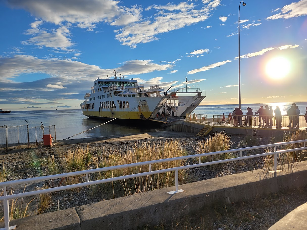
The next day, we set off for Tierra del Fuego. We crossed the Strait of Magellan on a regular ferry. The day was sunny, with little wind, very different from the previous one. We reflected on the shipwrecks that, for more than five decades since four vessels led by Ferdinand Magellan crossed the route in 1520, have fueled stories and legends of the region.
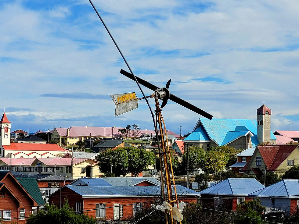
Tierra del Fuego is actually an archipelago. Its largest island, creatively named Isla Grande de Tierra del Fuego, has been home to diverse peoples for millennia. The most prominent, the Selk'nam (or Ona) and Yámana peoples, are responsible for the name that at first glance leads us to think of an island with volcanic activity. In fact, the name was given by the navigators of Magellan's expedition after seeing numerous bonfires of the native peoples along its coast. Punta Arenas, and its neighboring Chilean capital of Tierra del Fuego, Porvenir, are home to several monuments and museums that portray the terrible stories of the waves of genocide and diseases brought by the Europeans to their original peoples.
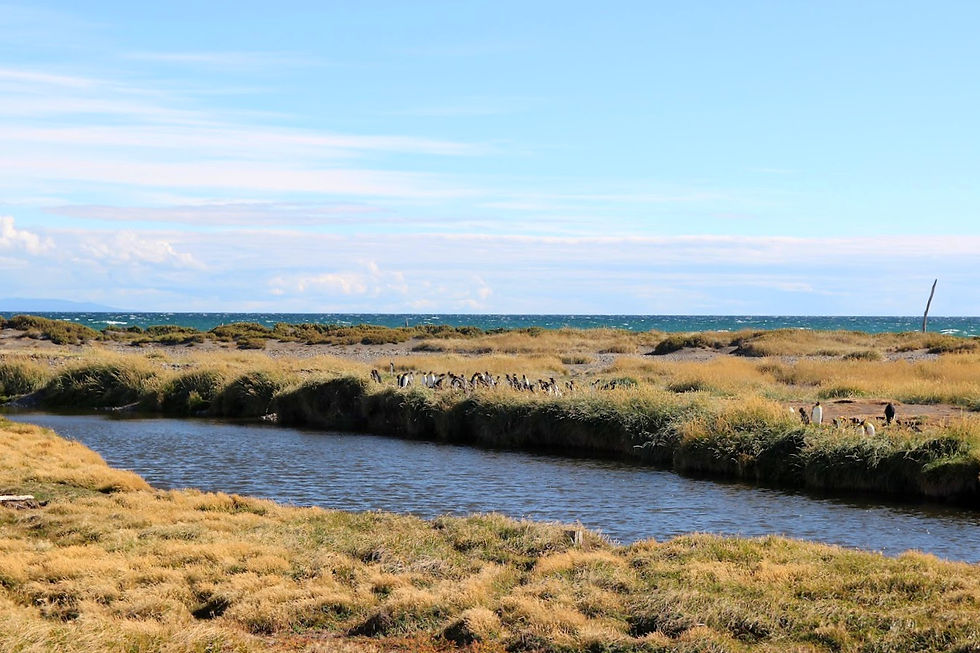
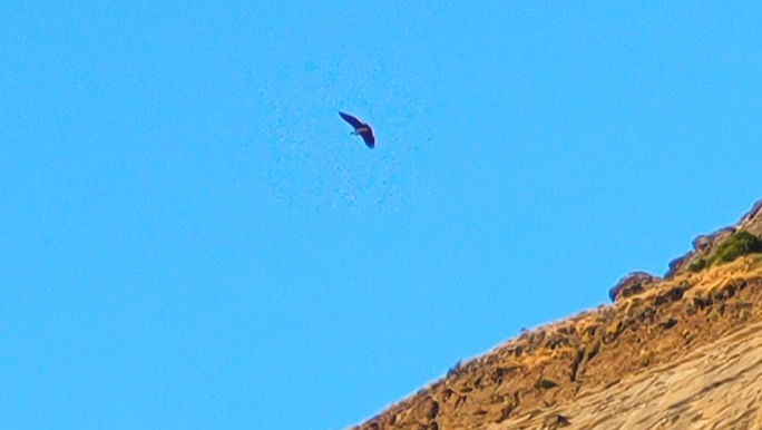
We continued to the northern tip of the island. We visited the Pingüino Rey Nature Reserve , a private initiative to protect the coastal biodiversity of Bahía Inútil . There we were able to see colonies of king penguins from a safe distance and in shelters designed for minimal interaction with their members.
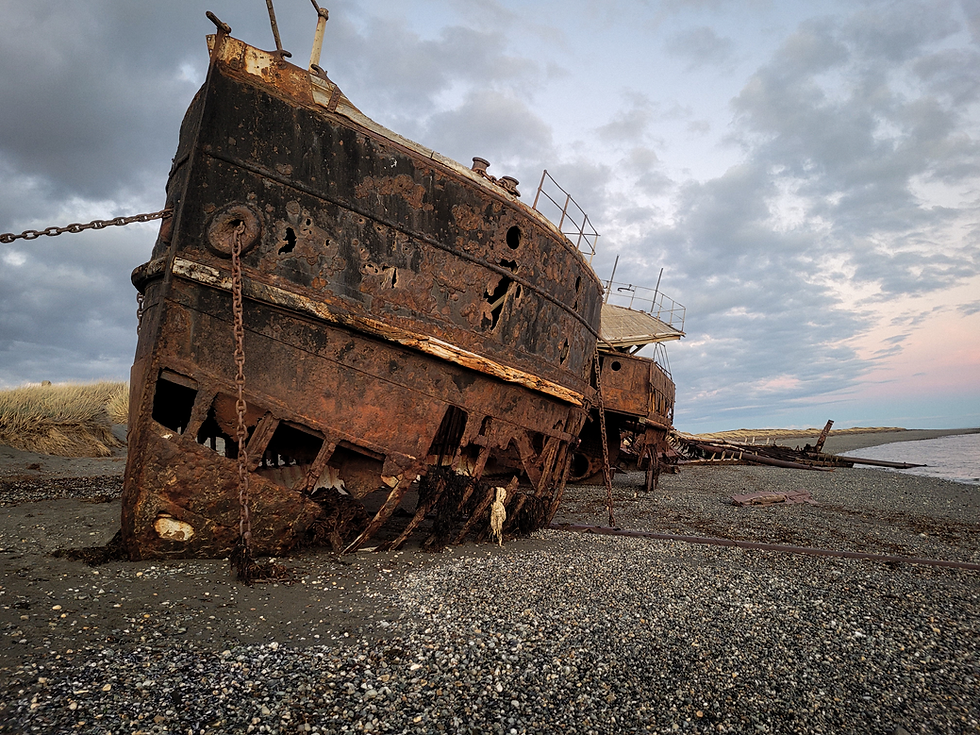
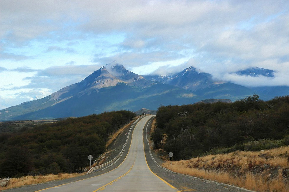
The next day was spent on the road. We traveled a section of the famous End of the World Route towards Puerto Natales. Along the road there are several viewpoints to admire the Patagonian plains. Small abandoned villages and corroded boats create dramatic scenes. The highlight is the small town of Puerto Harry and the remains of the steamship Amadeo (on the way, but visited the day before).
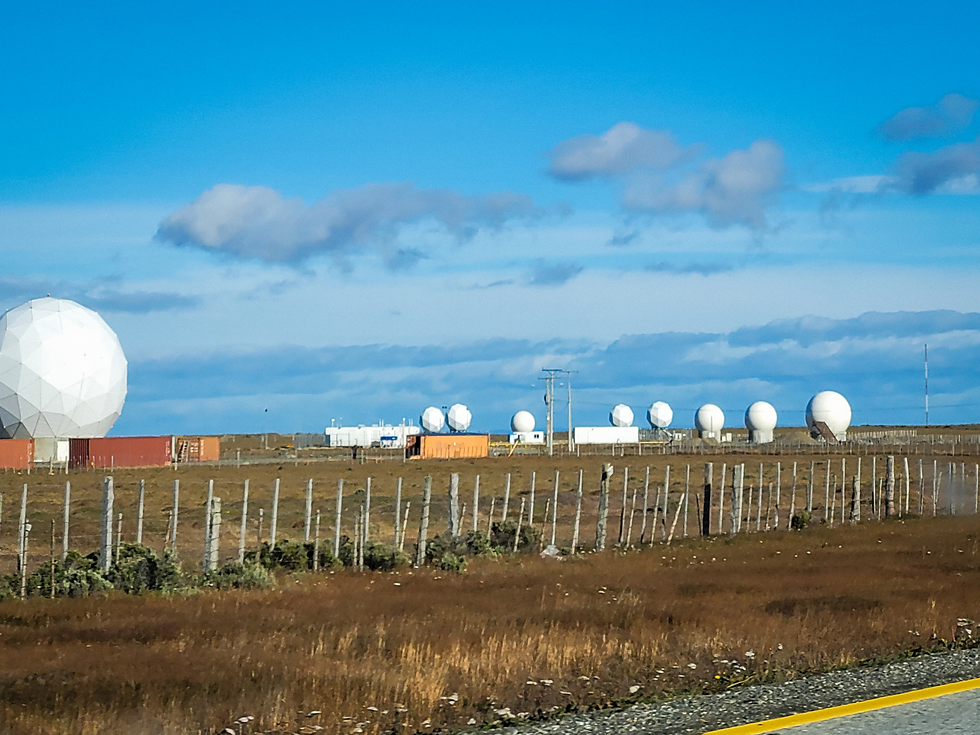
Punta Arenas is located at latitude 53S, which makes it an important area for satellite communications. You can see several teleports along the road just after leaving the city. The highlights are the Iridium gateways, the Swedish KSAT and the AWS base. The radomes, the spherical structures that protect the antennas from the elements, stand out in the landscape.
Arriving in Puerto Natales, we crossed some small mountains. The endless plains of the south were left behind. Some peaks still had a little snow. I don't know if it was from previous winters or recent ones. But it was indeed colder than the Punta Arenas region.
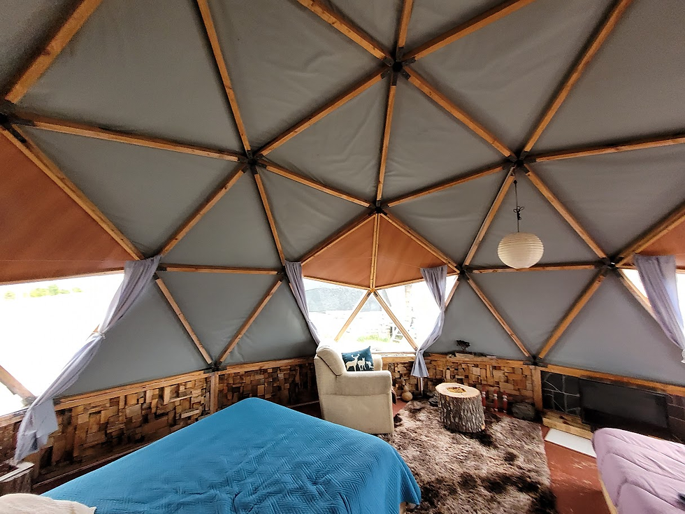
We stayed in geodesic domes at the foot of Cerro Dorotea . The local infrastructure was very simple, but the domes were excellent. Very cozy and with a peculiar decoration. It was worth the investment for the two nights before we exchanged the beds for tents.
Puerto Natales is noticeably more touristy than Punta Arenas. The city seems to revolve around it. There are more bars and restaurants to choose from. All the ones we went to were good, but they didn't beat La Luna and Mesita Grande. We filled up at a Petrobrás gas station, where a liter of gas cost practically the same as in Campinas - next to the Paulínia refinery.
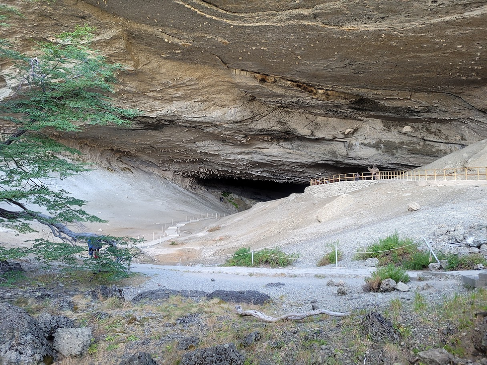
On our free day, we visited the Cueva del Milodon Natural Monument Park. The geological formation, which is over 20 thousand years old, is surprising. Glacier movements and subsequent erosion by a lake that formed there created caves with enormous openings. However, the main reason the region became famous was the discovery of fossils of the giant sloth (Milodon) and other prehistoric animals such as the saber-toothed tiger. The region is protected by the Chilean National Conservation Organization (CONAF).
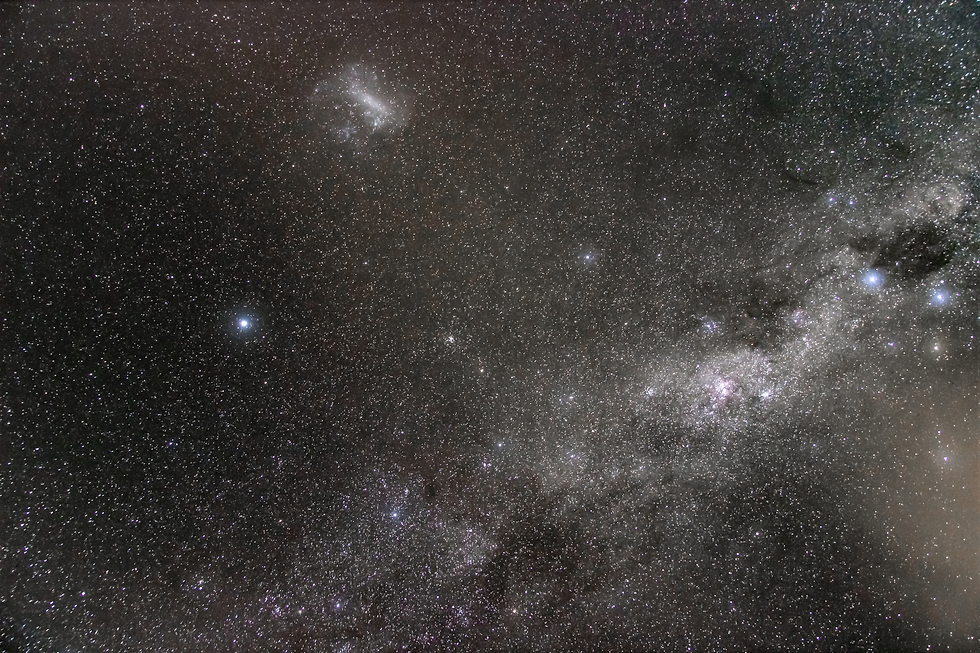
The domes, outside the city, are in a prime location for observing the night sky. Light pollution was minimal. A few thin clouds and moisture that condensed on the lenses like dew made it impossible to capture photos for stacking , but in the single frame below you can see an arm of the Milky Way and the Large Magellanic Cloud - a rather special sight in the region of the same name.

Comments